


Illustration by Israel G. Vargas
ChatGPT, how do we keep the world from starving?
There are no easy answers, but scientists are using machine learning to convert the vast amounts of data in satellite images of Earth into actionable insights.
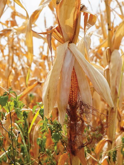
Canada’s farmland is drying out. Almost all agricultural land is experiencing “abnormally dry” conditions at best and “extreme drought” at worst, according to government data. Farmers are reporting dead crops and reduced yields. Meanwhile, scientists predict that the rate of climate change – which northern latitudes experience twice as fast as the global average – will make things even worse in coming years. What can Canada’s farmers and governments do to prepare?
That is a problem for Jonathan Proctor, assistant professor of food and resource economics at UBC, who uses cutting-edge satellite images and machine-learning techniques to learn what a heating planet will do to global food supplies and what we can do to keep the world fed.
“The big question of my work is, ‘How is agricultural productivity going to change under climate change, and what can we do about it?’” Proctor says.
In one sense, this problem is nothing new: the science of engineering agriculture for specific conditions – “agronomy” – emerged in the early 1900s, and humans have been adapting their crops to weather since the dawn of civilization. But human-caused climate change has made the relationship between weather and food supplies vastly harder to predict. For example, warmer weather might help some crops thrive at first, but how hot can it get before those same crops begin to die off? Some crops grown in northern latitudes are resistant to extreme temperature swings, but how will they react to longer-than-usual summers? Tropical crops are suited to year-round heat, but can they be planted in northern soils?
“Things that I would have assumed that we really know, we don’t. Like, how temperature, soil moisture, and sunlight influence crop yields. We should know that, and we really don't,” Proctor explains.
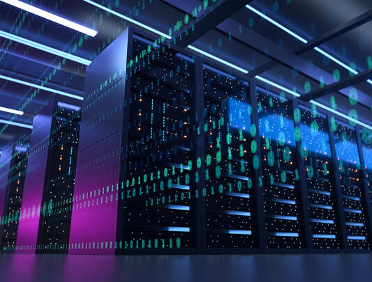
Fortunately, Proctor has one tool for answering those questions that the old-time agronomists lacked: space craft. Or, to be more precise, Earth observation satellites, more than 1,000 of which have given researchers access to formerly unfathomable quantities of remote-sensing data. Meanwhile, new advances in AI and machine learning are helping Proctor and his colleagues use that data to find patterns in the seeming chaos.
For one study, Proctor used remote-sensing tools to study how particles from volcanic eruptions affected crop growth, which will help model the effects of “solar geoengineering,” a theoretical climate solution that involves pumping reflective particles into the atmosphere to bounce a small portion of incoming sunlight back into space. Another study used satellite measurements to track soil moisture and estimate the impacts of water supply on crop productivity – which is a surprisingly non-straightforward relationship, says Proctor. “You can measure water that falls from the sky pretty easily, but the amount of water that falls from the sky is not necessarily the amount of water available in the soil, due to differences in evaporation rates, runoff rates, infiltration, things like that.”
This work doesn’t fit neatly into any single field. Proctor calls himself an “environmental data scientist” but jokes that he assumes the title “environmental economist” when networking with economists. He studied natural science in college, but earned his PhD in agricultural and resource economics. As he advanced his research (which includes work at Harvard’s Center for the Environment and Data Science Initiative before joining UBC), he embraced satellite imaging and data science simply because it provided the best solutions to the problems at hand.
“I'm trying to just pick the right tools for each job,” he explains. “We started the remote-sensing work because we noticed that a lot of the variables that we want to use just aren’t measured at the scales and locations we wanted to use them. And so initially thought, ‘Oh, we’ll just remotely sense them using satellite imagery.’”
But, he soon realized, “It turns out that's, like, quite hard to do.”
Apparently, one can’t simply say, “ChatGPT, please comb through remote-sensing data and tell us how to keep the world from starving.” Besides natural factors like heat, rainfall, and physical geography, the connections between climate change and food supplies include economic development, income inequality, infrastructure, access to healthcare, and countless other human variables.
Climate change has made the relationship between weather and food supplies vastly harder to predict, but Proctor has one tool that old-time agronomists lacked: space craft.
But soon, something like a ChatGPT for climate change could become a reality. Proctor has been working with a team of researchers from UC Berkeley and UC Santa Barbara to develop a tool that can distill vast quantities of information into usable insights for anyone with a laptop.
The project is called MOSAIKS, which stands for “Multi-Task Observation Using Satellites and Kitchen Sinks.” It uses machine learning to provide information on “everything and the kitchen sink,” from crop productivity, to deforestation and mining, to human development.
Health officials might one day use MOSAIKS to see how wildfires in Quebec are affecting asthma rates in Montreal. Or the government of Alberta might use it to predict how decreased mountain rainfall might affect wheat output in the lowlands. “I don’t know if this is a perfect analogy, but if [data analysis] were cooking, this is kind of like a frozen pizza. You just pop it in the oven. It does the hard parts for you,” Proctor explains.
Proctor is especially interested in how such tools could help communities in the Global South – low-income, usually agricultural economies are the most vulnerable to global warming. Thus far, highly developed countries have been the subjects of a large portion of the research at the intersection of agriculture and climate change simply because that is where the most technology, resources, and specialists happen to be.
“Many of the places that we really want to be studying from a welfare perspective, the data isn't as available.” Working with a consortium of experts, Proctor aims to help develop a “fine-resolution global yield database” that tracks the yields of crops in specific locations and conditions. Such a database would allow researchers to “study climate impacts everywhere, rather than just focusing where the data is easy to get.”
Whether or not policymakers will actually use these high-tech tools to protect their communities remains to be seen. “I don't know how much of the problem is in a lack of scientific knowledge,” Proctor says. “The main hurdle I see is political will.” Indeed, there are factors, such as corporate influence, popular opinion, and the whims of specific politicians, that are far beyond the reach of any algorithm.
Still, Proctor believes the more society knows about the future of the planet, the more it will do to prepare. “There is still a lot of uncertainty in all of this, but you still want to aim for the centre of the bull’s-eye.”